Connecticut Hill Wildlife Management Area - Van Lone Hill Loop
To start off, let me first say that this hike turned out to be much longer than I anticipated. What I thought would be an 8 to 9 miler at most was a nearly 14-mile trek, after all was said and done. This was a direct result of me choosing to add a leg of additional trail to an already sizable loop described and detailed in a local Central New York hiker's guide book. But I'm definitely not complaining - it was a terrific, if not, at times, exhausting long walk that likely made for some decent physical conditioning. I completed this hike at the onset of the month of May with a good friend of mine who also enjoys the outdoors and the Finger Lakes region, in particular. He was also looking for fresh wild, edible mushrooms like morels (which are legal and can be added to foods). We did not find any, however, but the six hours we hiked through some deep forests of Connecticut Hill WMA were enjoyable and yielded some scenic photos, I believe.
Recall from an earlier posting that Connecticut Hill is a forested plateau that resembles the shape of a "thumb" about a fifteen to twenty minute car ride southwest of Ithaca, NY. This is prime Finger Lakes upper hill country here, and also happens to be the highest point in Tompkins County and the northernmost reaches of the vast Appalachian Plateau (which stretches all the way south to Alabama and Georgia). Some guide books detail a delightful hike that uses a portion of the Finger Lakes Trail (FLT) which runs parallel to Cayuta Creek and then an orange-blazed, unnamed spur trail of the FLT. The loop is one of the more rugged ones I've taken on recently with an elevation change of over 1,000 feet. Not bad for Central New York!
I began this hike at an FLT trail head off of dirt Boylan Road which is almost in the middle of the WMA property. I must note that this hike started at the exact point where I turned back in my last visit to Connecticut Hill last summer (see Bob Cameron Loop post). Hiking immediately in a southwestern direction, the path traversed mature, mixed hardwoods with an abundance of oaks that were still bare of any leaf buds in spite of it being May (high elevation coupled with below normal temps this spring made it that way).
An open area, slightly muddy in spots, was reached next. I have found there are several of these scattered through Connecticut Hill.
Re-entering the woods, it remained cloudy in spite of a sunny forecast (this would change for the better very soon).
A second clearing, this time a measure larger, with some healthy-looking cedar trees.
All the rain the region has had in recent weeks served to accentuate numerous seasonal creeks (like the one pictured). Quite nice!
Once the sun started to come out, the hike became a little more hilly, which hinted that things were about to get a whole lot more interesting!
The next section of the trail was spectacular, coming out above the gorge cut over eons by this northern reach of Cayuta Creek, which will eventually widen and travel several miles to drain into remote Cayuta Lake in Schuyler County. Plentiful water made these falls heavier and rushing into rapids far below the classic Finger Lake hemlock-fringed slopes.
The FLT continued to follow the course of the creek southwest through these more rugged hills and my friend and I both had to be careful not to trip over rocks and thick branches on the path. Downhill for a bit, and then into a creek crossing and a scenic basin which looks prone to flooding.
One of the most strikingly gorgeous parts of this trail I've blogged in recent memory came after. Cayuta Creek widened further from its source and natural limestone walls guarded this deep enclave. The waters rushed with greater strength, making home to water plants like the bright green, broad-leafed skunk cabbage pictured below. And a unique, old wooden bridge, well-built, crossed water that would have been too deep to ford.
Standing on the bridge, looking ahead was this waterfall:
A break at this place to watch the waters was warranted, by this point, and we were already clocking the miles in. The FLT suddenly veered to the right after the bridge crossing and traveled northwest, following even closer Cayuta Creek which was now a calmer, almost river-like widening waterway.
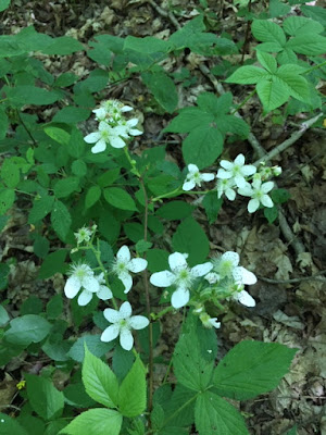
Spring wildflowers and a companion garter snake:
The creek - muddy in color from excess rainfall, perhaps:
County Route 6 (Schuyler County) borders the WMA, but the FLT continues its journey west into other lands, apparently passing this wetland first.
As though all that great scenery wasn't enough, this loop was only 2/3rds the way complete. An orange-blazed spur of the FLT, mentioned earlier, banked a sharp right, going straight uphill in the direction of northeast. This turned out to be the actual steepest climb of the hike, which given my reduced energy levels by this time, made it a little more taxing. Once at the top of the hill, however, the ground leveled out quite well and the path followed along a double-track through thick forests.
Someone with a sense of humor?? decorated this tree for a year-round Christmas:
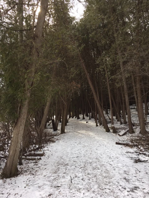
The orange trail crosses the plateau:
Mountain views in the distance:
On the least segment of the spur trail, I crosses a few more streams.
After this point, the orange trail reconnected with the FLT and we were tasked with returning on the first branch of our hike. The Van Lone Loop was interesting, to say the least, and was one I've wanted to accomplish for quite a while now. When my hiking buddy and I returned to the car, we were very tired but glad to have seen this corner of the Finger Lakes.


Comments
Post a Comment