Danby State Forest - Michigan Hollow to Tamarack Lean-to
Last summer I described my journey along the popular Abbot Loop in Danby State Forest, just south of the small city of Ithaca, NY. Well, it also turns out a gorgeous stretch of the nearly 600-mile long Finger Lakes Trail (FLT) crosses Danby State Forest in a mainly west to east direction, passing through deep mixed deciduous hardwood forests that are splendidly green and lush come mid-June. As you may recall, these protected lands are part of the expansive "Emerald Necklace", a belt-like corridor existing south of Cayuga Lake, one of the Finger Lakes.
My goal of this hike was to reach the Tamarack Lean-to, built a decade ago, and then retrace my steps back to my starting point in the hillside cut Michigan Hollow. I've only visited this lean-to once, and my memory of the trail to get there is a bit foggy, at best, so I was eager to revisit. And once the FLT continues past the reaches of the Abbot Loop, other hikers aren't as frequent as this part isn't as well-traveled.
The weather was perfect when I began my hike at the trail head off dirt Michigan Hollow Road - late spring dry air, low humidity, blue skies, and temps reaching the mid 70s. I entered the forest along the well-built path and was immediately engulfed in the shade of thick trunks and high, healthy canopy.
It wasn't long before the hike presented its first uphill stretch. The woods rapidly transitioned to more hemlock and occasional stands of mature beech trees for those more attentive.
On the Abbot Loop hike, the orange trail splits just after "Diane's Crossing", heading south and then eventually west to complete a longer 8-mile loop. But I continued eastward on the white-blazed FLT, passing a red pine plantation where trees planted in the 1930s form tidy if not unnatural pencil-straight rows. After crossing rugged dirt Curtis Road, I hiked with careful footing down an extremely steep hillside which I knew full well I'd have to return uphill on when returning later. Better ration my energy!
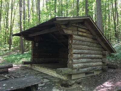
This particular lean-to was rebuilt in 2010 and awarded me with a very scenic, peaceful view of the deep woods ahead. No views here, but that was okay and it still seemed a great camping spot along the FLT.
I soon returned the way I came of course, but a bit faster, I must add, so that I could reach my car before 6 PM. Along the way I found more wildflowers - this time the pink, white, and violet Dame's Rocket.
My goal of this hike was to reach the Tamarack Lean-to, built a decade ago, and then retrace my steps back to my starting point in the hillside cut Michigan Hollow. I've only visited this lean-to once, and my memory of the trail to get there is a bit foggy, at best, so I was eager to revisit. And once the FLT continues past the reaches of the Abbot Loop, other hikers aren't as frequent as this part isn't as well-traveled.
The weather was perfect when I began my hike at the trail head off dirt Michigan Hollow Road - late spring dry air, low humidity, blue skies, and temps reaching the mid 70s. I entered the forest along the well-built path and was immediately engulfed in the shade of thick trunks and high, healthy canopy.
It wasn't long before the hike presented its first uphill stretch. The woods rapidly transitioned to more hemlock and occasional stands of mature beech trees for those more attentive.
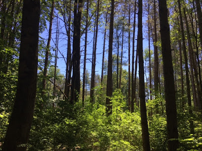
The FLT banked southward, now following the top of a ridge running more or less parallel with Michigan Hollow Road (fortunately the road could no longer be heard by this point). Some spots opened up a bit, with tall red pines reaching their long, thin trunks up to the sun.
Within a mile and a half, I reached a small wetland area known as "Diane's Crossing". A footbridge crosses this old sawmill site, and I enjoyed seeing the grasses coming out of the water.
On the Abbot Loop hike, the orange trail splits just after "Diane's Crossing", heading south and then eventually west to complete a longer 8-mile loop. But I continued eastward on the white-blazed FLT, passing a red pine plantation where trees planted in the 1930s form tidy if not unnatural pencil-straight rows. After crossing rugged dirt Curtis Road, I hiked with careful footing down an extremely steep hillside which I knew full well I'd have to return uphill on when returning later. Better ration my energy!
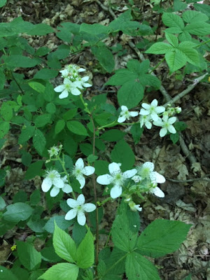
Bright wildflowers along the trail:
One of the more secluded, lovely spots along this hike was this small unnamed creek crossing after reaching the bottom of that steepest hill. Here I discovered a new footbridge, a somewhat rocky creek beginning to dry out from all the rain free weather Central New York has had, and a place to sit, take a rest, and listen to birdsong deep in the branches.
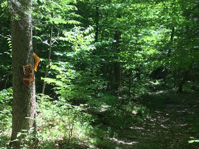
Up the trail a short way, a crossing with a snowmobile corridor path (these are always numbered and cross many counties and state lands):
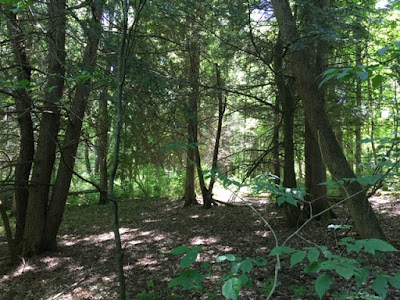
By noontime, I was reaching what is likely, according to maps I've viewed, the geographical middle of Danby State Forest, and it's here where the forest type became suddenly more varied. More pine plantations gave way to what appeared a younger forest of crabapple trees, white pines, cedars, black cherry trees, and a thick understory. It almost appears some of this land was farmed as recently as perhaps fifty years ago?
I then crossed paved South Danby Road, which I was happy to find was not busy at all. Continuing east in what was now mainly unfamiliar territory, I followed those reliable white blazes through more forests thick with hemlock stands, several dry creek crossings, more red pine stands, and tall, wild fern undergrowth that was worth capturing on photo.
Ladybug going for a climb:
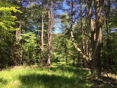
This open grassy area was appealing to me, for some reason. It could have been the lighting or the fact that I knew I was now getting closer to the lean-to (according to maps).
The last eastbound segment before the lean-to was flat and easy to walk along; the trail also widened in such a way that I believe it was using an old logging road.
Just around the bend, underneath tall hardwoods glowing in the 3 PM sun, I saw the Tamarack Lean-to through the trees! I had reached my destination in spite of this whole hike getting a late morning start. Although it can't be seen in pictures, there were blue-blazed paths sprawling out from the lean-to leading to water springs for overnight campers.
I soon returned the way I came of course, but a bit faster, I must add, so that I could reach my car before 6 PM. Along the way I found more wildflowers - this time the pink, white, and violet Dame's Rocket.
This hike took me a little over 5 hours to complete and had an elevation gain of just over 500 feet. I was glad to see more of this state forest, and I've seen from maps that beyond this lean-to is a section known as Eastman Hill. Maybe some other time a visit to explore there . . .













Comments
Post a Comment