Kennedy State Forest - Virgil Mountain Loop
Springtime can be one of the best times of year to hike Central New York, so long as there isn't too much rain falling. The streams are usually gushing from snow melt and the hills of the region are crowned in young-looking green from all the new leaf growth. In the woods, the world seems to be coming back to life. So in the middle of May, hiking the nearly 5-mile Virgil Mountain Loop seemed enticing to me. There's much to see here, and in a relatively short amount of time. The hike I will describe in this blog took me about 3 hours to complete, almost to the minute.
Several entries ago I described the Swedish Loop in Kennedy State Forest, a piece of wild land tucked away in southern Cortland County. This time, a segment further east along the Finger Lakes Trail (FLT) in Kennedy State Forest brings one to the highest point in the county at 2132 feet above sea level, otherwise known as Virgil Mountain. Greek Peak ski resort is also adjacent to the summit (there's a decent amount of snowfall here in winter months).
I began my hike at the point where the Finger Lakes Trail crosses unpaved Bleck Road, a few miles drive southeast of the hamlet of Virgil, NY. This is prime hill country here, and the drive to the trail itself rewarded me with distant views mainly to the south, east, and west. A green sign by the road shoulder indicated the FLT, so from here I started eastward.
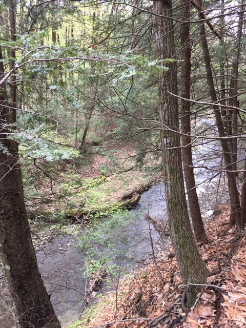
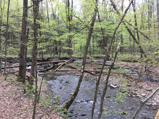
It wasn't very long before I felt deep in the woods, and it also wasn't long before I had to make my way downhill to a stream that has cut into the hillsides. This scenic creek, running north to south, required I cross it using some well-placed rocks. The water was somewhat fast moving, but definitely not deep enough where I couldn't pass.
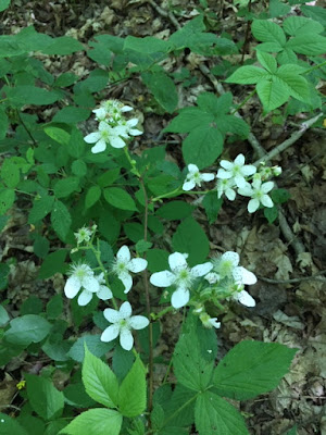
Further down the trail, I followed the creek's eastern side for what seemed like perhaps a quarter of a mile. The forest here is a mix of hemlocks and deciduous hardwoods along with a pretty flowering tree at the path's edge.

The walking here is mainly level so this was a good stretch to gather some speed, as I was on a time limit this day (family barbecue in the evening planned). Eventually the FLT, after passing through more intermittent hardwood stands and evergreens, reached the junction with an orange-blazed pathway. To the west, the orange trail is named the Dabes Diversion Loop and, to the east, it is named the Virgil Mountain Loop. It turns out my return loop would end up right back at this spot coming down along the Virgil Mountain Loop. But, for now, I continued in a northerly direction along the white-blazed FLT. (Side note: I have read the FLT uses white paint blazes on trees as a clear indicator just like the Appalachian Trail does.)
I was happy the sun started filling the sky more by this point. Makes for better pictures, in my opinion. And the trail, remaining level, passed by small stands of young spruce trees, adding a bit to the scenery's variety.
Another crossing of the many seasonal streams found in Kennedy State Forest.
The trail now reached and followed for a bit Odell Road, which is dirt and affords some views to the east.
After turning right off of Odell Road, the FLT picked up and continued into more hardwoods and frequent stream crossings.
The trek from here onward was uphill for a while, bringing me to grounds of the Greek Peak ski resort I mentioned earlier. I wandered briefly off the main path to one of the dormant ski trails and was delighted to find some great views to the northeast (this is a mere foreshadowing of what's to come!).
Now the trail reached the highest point in the county. The views at Virgil Mountain's summit are astounding considering this is not the Adirondacks and Central New York lacks true mountain ranges. And in the past couple of years, local Boy Scouts constructed a bench so you can sit and take in the views.
Looking north and east, I couldn't help marvel at the vastness of New York State and all its natural beauty, and I'm happy to share this with others.
I spent a few minutes here, recharged, and headed south along a power line right-of-way that actually is more scenic than you would think. The FLT banked to the left and continued its long journey east to the Catskills, but I kept south on the orange-blazed Virgil Mountain Loop. Following the power lines for several minutes, I was careful to keep to the orange trail as it re-entered the woods, travelling west in what would be my return leg of this trip.
The Virgil Mountain Trail, a little wider than the FLT, coincides with a snowmobile route for part of the time. This became a pleasant, unwinding, mostly downhill hike through healthy maples and oaks.
Some sections of the trail were muddy, as you can see in the picture above. From this point, I was feeling the urgency to return to my car in the interest of time, so I followed the orange trail further west, past the first FLT crossing mentioned much earlier, and now hooked onto the Dabes Diversion Loop. This I followed up a surprisingly strenuous hill, passed some logged woods, and then finally onto a blue-blazed foot path named the Kuzia Cut-off, which went south and would eventually reconnect with the FLT near the trail head where I started.
I guess if my entire hike here were mapped out, if would resemble a lopsided figure-8 shape. This was a great walk and it's one that always invigorates me! I know the hike was a success when I leave it promising to return someday.
Several entries ago I described the Swedish Loop in Kennedy State Forest, a piece of wild land tucked away in southern Cortland County. This time, a segment further east along the Finger Lakes Trail (FLT) in Kennedy State Forest brings one to the highest point in the county at 2132 feet above sea level, otherwise known as Virgil Mountain. Greek Peak ski resort is also adjacent to the summit (there's a decent amount of snowfall here in winter months).
I began my hike at the point where the Finger Lakes Trail crosses unpaved Bleck Road, a few miles drive southeast of the hamlet of Virgil, NY. This is prime hill country here, and the drive to the trail itself rewarded me with distant views mainly to the south, east, and west. A green sign by the road shoulder indicated the FLT, so from here I started eastward.
It wasn't very long before I felt deep in the woods, and it also wasn't long before I had to make my way downhill to a stream that has cut into the hillsides. This scenic creek, running north to south, required I cross it using some well-placed rocks. The water was somewhat fast moving, but definitely not deep enough where I couldn't pass.
Further down the trail, I followed the creek's eastern side for what seemed like perhaps a quarter of a mile. The forest here is a mix of hemlocks and deciduous hardwoods along with a pretty flowering tree at the path's edge.

The walking here is mainly level so this was a good stretch to gather some speed, as I was on a time limit this day (family barbecue in the evening planned). Eventually the FLT, after passing through more intermittent hardwood stands and evergreens, reached the junction with an orange-blazed pathway. To the west, the orange trail is named the Dabes Diversion Loop and, to the east, it is named the Virgil Mountain Loop. It turns out my return loop would end up right back at this spot coming down along the Virgil Mountain Loop. But, for now, I continued in a northerly direction along the white-blazed FLT. (Side note: I have read the FLT uses white paint blazes on trees as a clear indicator just like the Appalachian Trail does.)
I was happy the sun started filling the sky more by this point. Makes for better pictures, in my opinion. And the trail, remaining level, passed by small stands of young spruce trees, adding a bit to the scenery's variety.
Another crossing of the many seasonal streams found in Kennedy State Forest.
The trail now reached and followed for a bit Odell Road, which is dirt and affords some views to the east.
After turning right off of Odell Road, the FLT picked up and continued into more hardwoods and frequent stream crossings.
The trek from here onward was uphill for a while, bringing me to grounds of the Greek Peak ski resort I mentioned earlier. I wandered briefly off the main path to one of the dormant ski trails and was delighted to find some great views to the northeast (this is a mere foreshadowing of what's to come!).
Now the trail reached the highest point in the county. The views at Virgil Mountain's summit are astounding considering this is not the Adirondacks and Central New York lacks true mountain ranges. And in the past couple of years, local Boy Scouts constructed a bench so you can sit and take in the views.
Looking north and east, I couldn't help marvel at the vastness of New York State and all its natural beauty, and I'm happy to share this with others.
I spent a few minutes here, recharged, and headed south along a power line right-of-way that actually is more scenic than you would think. The FLT banked to the left and continued its long journey east to the Catskills, but I kept south on the orange-blazed Virgil Mountain Loop. Following the power lines for several minutes, I was careful to keep to the orange trail as it re-entered the woods, travelling west in what would be my return leg of this trip.
The Virgil Mountain Trail, a little wider than the FLT, coincides with a snowmobile route for part of the time. This became a pleasant, unwinding, mostly downhill hike through healthy maples and oaks.
Some sections of the trail were muddy, as you can see in the picture above. From this point, I was feeling the urgency to return to my car in the interest of time, so I followed the orange trail further west, past the first FLT crossing mentioned much earlier, and now hooked onto the Dabes Diversion Loop. This I followed up a surprisingly strenuous hill, passed some logged woods, and then finally onto a blue-blazed foot path named the Kuzia Cut-off, which went south and would eventually reconnect with the FLT near the trail head where I started.
I guess if my entire hike here were mapped out, if would resemble a lopsided figure-8 shape. This was a great walk and it's one that always invigorates me! I know the hike was a success when I leave it promising to return someday.


Comments
Post a Comment