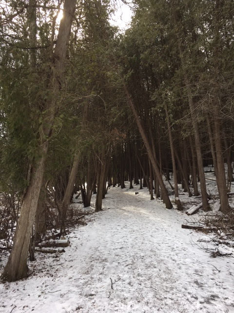
Danby State Forest - Abbot Loop
In my last blog I mentioned briefly the "Emerald Necklace", a large swath of connected preserved lands straddling south of Ithaca, NY and Cayuga Lake. Danby State Forest, 7,651 acres in size and a few miles directly south of the city of Ithaca, is one piece of the "Emerald Necklace" and - from what I've found, a great place to go for some fairly rugged hiking.
The hike I'm about to detail is one of the more popular hiking loops in this region, and also one I've traveled several times over the years. It's another one of those walks I can file into the "never gets old" category; I enjoy it each time as though it were my first visit. Hiking the Abbot Loop does not require any backtracking, either, which is a huge bonus for me since many outings in Central New York, it seems, are not clear-cut loops. Whenever I come here, the sense of deep wilderness abounds in spite of the fact that human development is near and this is not far into the mountains. But it's still a great place, growing lush with tall, old hardwoods only broken by quiet streams and hidden forest ravines. And - oh - there happens to be a summit and view along the trail, too.
The Abbot Loop usually takes me roughly four hours to complete, and this was the case on my recent visit at the end of June. The loop's ruggedness arrives in the form of many ups and downs along the orange-blazed path and an overall elevation change of over 1500 feet. So I would recommend tackling this hike with a good amount of energy.
I began my hike on a not-too-warm early summer day (highs in the low to mid 80s) at the trail head along unpaved Michigan Hollow Road in the hamlet of Danby, NY. The familiar white-blazed Finger Lakes Trail crosses this road west to east in its long journey across the state, and here I picked up the trail heading west, coming upon a bridge over gorgeous Michigan Hollow. I would not be on the Finger Lakes Trail very long, for I turned left onto the orange-blazed Abbot Loop Trail which I would be on for several miles.
Intermittent uphill climbing characterized the first leg of the Abbot Loop Trail, taking me under the shade and canopy of mixed hardwoods and hemlocks. Barely a mile in, I came upon this interesting discovery: it seems a new path has been built named the Dove's Loop. Past this new spur, the orange trail crossed a pretty stream that had cut into the hillside.
There was more uphill to tackle after crossing Michigan Hollow Road (a bit further south from the trail head where I started, I should note). This stretch had me sweating, to say the least. It was a long slog uphill on this eastern side of Michigan Creek and, to be honest, knowing there were no views to greet me at the top made this part somewhat tedious. But once I reached the higher hills near 1600 feet, I returned into the green shades of fully-leafed beech, maple, and oak trees.
Some young "quaking" aspen trees in this small clearing by where the trail crosses a jeep trail:
It was just after 2 in the afternoon when I came onto the easternmost leg of the Abbot Loop. This delightful segment was marked by deep, thick deciduous woods, another downhill trek, a nice creek bridge crossing, and then, within a half-an-hour of more stream-side walking, the terminus of the orange trail at the Finger Lakes Trail (FLT) by this well-placed sign.
If I elected to, I could have continued hiking east on the FLT into a forest of red pine, but my energy was lower now and time also wouldn't allow. So instead I turned left (west) on the white-blazed FLT and immediately waded through the very tall grasses and shrubs of a wet area known as "Diane's Crossing". At one time, a saw mill operated here, I've read.
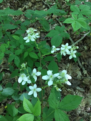
Wild raspberries:

The final segment of this loop hike took me westward along the FLT down a hemlock-fringed hillside, the type that is so common in this region. Twenty minutes or so later and almost out of water to drink, I passed over this seasonal creek kissed with wildflowers and then reached my starting point from the morning on Michigan Hollow Road. What a day well spent in the woods!
The hike I'm about to detail is one of the more popular hiking loops in this region, and also one I've traveled several times over the years. It's another one of those walks I can file into the "never gets old" category; I enjoy it each time as though it were my first visit. Hiking the Abbot Loop does not require any backtracking, either, which is a huge bonus for me since many outings in Central New York, it seems, are not clear-cut loops. Whenever I come here, the sense of deep wilderness abounds in spite of the fact that human development is near and this is not far into the mountains. But it's still a great place, growing lush with tall, old hardwoods only broken by quiet streams and hidden forest ravines. And - oh - there happens to be a summit and view along the trail, too.
The Abbot Loop usually takes me roughly four hours to complete, and this was the case on my recent visit at the end of June. The loop's ruggedness arrives in the form of many ups and downs along the orange-blazed path and an overall elevation change of over 1500 feet. So I would recommend tackling this hike with a good amount of energy.
I began my hike on a not-too-warm early summer day (highs in the low to mid 80s) at the trail head along unpaved Michigan Hollow Road in the hamlet of Danby, NY. The familiar white-blazed Finger Lakes Trail crosses this road west to east in its long journey across the state, and here I picked up the trail heading west, coming upon a bridge over gorgeous Michigan Hollow. I would not be on the Finger Lakes Trail very long, for I turned left onto the orange-blazed Abbot Loop Trail which I would be on for several miles.
Intermittent uphill climbing characterized the first leg of the Abbot Loop Trail, taking me under the shade and canopy of mixed hardwoods and hemlocks. Barely a mile in, I came upon this interesting discovery: it seems a new path has been built named the Dove's Loop. Past this new spur, the orange trail crossed a pretty stream that had cut into the hillside.
I next crossed dirt/gravel Bald Hill Road and followed the splendid sylvan trail further uphill through unbroken, healthy forest. My reward for the work of reaching the top of the hill (at 1700 feet above sea level) were these views to the west overlooking the valley below and the hill country beyond. This beautiful, well-known spot is named "Thatcher's Pinnacles". So I sat at an old wooden picnic table built here and took a short break, enjoying the constant breeze that made the air just a little cooler.
The Abbot Loop Trail headed south under tall oaks, then banked east, traversing a wonderful section of spruces, firs, and some hardwoods that just "glowed" in the sunshine. The air was warming, so I was glad to be hiking downhill, by this point.
The next couple of miles of the trail journeyed south again to follow along the banks of a stream. At times, it seemed the path was actually in the stream itself. I had to move fast through this section as flies were swarming badly around here, and stopping, even if for a couple seconds, brought more buzzing around my head. Not ideal. But I kept going and was glad to be able to snap a few pictures, especially one of that deep blue sky!
There was more uphill to tackle after crossing Michigan Hollow Road (a bit further south from the trail head where I started, I should note). This stretch had me sweating, to say the least. It was a long slog uphill on this eastern side of Michigan Creek and, to be honest, knowing there were no views to greet me at the top made this part somewhat tedious. But once I reached the higher hills near 1600 feet, I returned into the green shades of fully-leafed beech, maple, and oak trees.
Some young "quaking" aspen trees in this small clearing by where the trail crosses a jeep trail:
It was just after 2 in the afternoon when I came onto the easternmost leg of the Abbot Loop. This delightful segment was marked by deep, thick deciduous woods, another downhill trek, a nice creek bridge crossing, and then, within a half-an-hour of more stream-side walking, the terminus of the orange trail at the Finger Lakes Trail (FLT) by this well-placed sign.
If I elected to, I could have continued hiking east on the FLT into a forest of red pine, but my energy was lower now and time also wouldn't allow. So instead I turned left (west) on the white-blazed FLT and immediately waded through the very tall grasses and shrubs of a wet area known as "Diane's Crossing". At one time, a saw mill operated here, I've read.
Wild raspberries:

The final segment of this loop hike took me westward along the FLT down a hemlock-fringed hillside, the type that is so common in this region. Twenty minutes or so later and almost out of water to drink, I passed over this seasonal creek kissed with wildflowers and then reached my starting point from the morning on Michigan Hollow Road. What a day well spent in the woods!
The Abbot Loop is detailed in a few local hiking guide books, but I hope my photos translate the appeal of this place. This was actually one of the first hikes I ever did in the Finger Lakes area ten summers ago. Visiting once more all this time later only reinforces how much I love these woods!
Until next time . . . 


Comments
Post a Comment