Pharsalia Wildlife Management Area - "Waterfalls of Pharsalia" to Canasawacta Creek
In early July, I set out to explore and experience a segment of the Finger Lakes Trail that, it turns out, is the furthest east along the long-distance path I have hiked to date. In the northern tier of rural Chenango County in Central New York lies the Pharsalia Wildlife Management Area, 4,689 acres in size and operated by the DEC. At first glance on a map, it would appear to be a place for merely hunters to look for game in the spring and fall and not much of a draw for hikers, but the reality is far from the truth. There is a very scenic and remote piece of the FLT running southward through these game lands, and some surprising geographical variety for an area that is largely flatter than its surrounding brethren. For anyone interested in the outdoors as I am, I would recommend checking this lesser-known place out.
The hike I will describe in this blog took me roughly four-and-a-half hours to complete and was an out-and-back, so figure approximately two hours and fifteen minutes in either direction. The draws of this particular hike were a series of waterfalls in the woods, deep, undisturbed expanses of mature hardwood forest, a freshwater pond, old pasture fields, and a pretty creek cutting through the shale stone.
I began the hike at the FLT trail head on Stage Road which runs off of NYS Route 26 just south of the village of Otselic. I started heading south on the trail (east by FLT designation) up along the edge of a sloping field where enticing views to the west and northwest greeted me at once. I can't think of any other hikes I've undertaken recently where, within the first few minutes, there are panoramic views!
The grassy field, I must note, was on private land that some generous landowner allowed hikers to walk through. Thanks to these people, I was able to see these views.
Further along, the trail entered forest and, at the same time, the boundaries of the Wildlife Area. Some downhill hiking led to a creek crossing where I found a new footbridge had been constructed, followed by some uphill climbing through mixed beech, maple, and hemlock.
The trail, after bending east and then abruptly south again, ran along the edge of a stream where small waterfalls cut a thin gorge into the forest terrain. I found this a beautiful, if not slippery and hilly, section of the hike.
I should mention this trail segment has been maintained and groomed by members of the local FLT-Bullthistle Hikers Club based out of the town of Norwich, NY. I think they've done a terrific job!
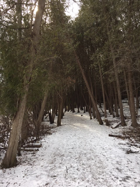
The second, or what I would call the "middle" part of this hike, traversed a mainly flat forested plateau. Here I hiked for nearly 50 minutes at a peaceful pace, stepping under the crowning canopy of trees much older than I. The path was mostly straight, albeit it winded in places where I least expected.
I found this to be a welcomed part of the trail, since my outing started with all that up-and-down business. And when I came to this Wegmans sign post, I knew I was closer to Jackson Pond. This also happens to be a part of a hike in a Wegmans food store outdoor book (something the store does to encourage people to get outside and exercise).
The FLT eventually wrapped around the western wooded side of Jackson Pond, and it was at this point I could see the water through the woods.
Reaching Jackson Pond was a treat, and a superb spot to take a break. There were dragonflies everywhere, and the water was perfect under the early afternoon sun.
Now I could've turned back at this watering hole, having already seen some interesting places, but I had the time and I was drawn to keep going. I'm glad I did, because what I'll call the third section of my hike was a bit different in character than the "middle" portion. Deeper in here I found shadier woods of old firs and hemlocks, along with the distinct yellow birch and its "papery" bark.
There were some peculiar tracts of field cutting through the otherwise dense forest, and nearby the stone remains of a 1930s Civilian Conservation Corps Camp. I'm not certain if the two are related, but it might be something interesting to research. The camp relic, by the way, was covered in an under story of periwinkle.
The FLT traveled onward, soon turning right and joining a dirt road (Elmer Jackson Road) where I came upon this second pond fringed by evergreens.
All in all, my hike at Pharsalia Wildlife Management Area was a great way to enjoy a summer's day in a more remote corner of the Central New York region. I'm thoroughly enjoying seeing more and more of the Finger Lakes Trail and certainly look forward to someday seeing what lies beyond the boundaries of this game preserve.
The hike I will describe in this blog took me roughly four-and-a-half hours to complete and was an out-and-back, so figure approximately two hours and fifteen minutes in either direction. The draws of this particular hike were a series of waterfalls in the woods, deep, undisturbed expanses of mature hardwood forest, a freshwater pond, old pasture fields, and a pretty creek cutting through the shale stone.
I began the hike at the FLT trail head on Stage Road which runs off of NYS Route 26 just south of the village of Otselic. I started heading south on the trail (east by FLT designation) up along the edge of a sloping field where enticing views to the west and northwest greeted me at once. I can't think of any other hikes I've undertaken recently where, within the first few minutes, there are panoramic views!
The grassy field, I must note, was on private land that some generous landowner allowed hikers to walk through. Thanks to these people, I was able to see these views.
Further along, the trail entered forest and, at the same time, the boundaries of the Wildlife Area. Some downhill hiking led to a creek crossing where I found a new footbridge had been constructed, followed by some uphill climbing through mixed beech, maple, and hemlock.
The trail, after bending east and then abruptly south again, ran along the edge of a stream where small waterfalls cut a thin gorge into the forest terrain. I found this a beautiful, if not slippery and hilly, section of the hike.
I found this to be a welcomed part of the trail, since my outing started with all that up-and-down business. And when I came to this Wegmans sign post, I knew I was closer to Jackson Pond. This also happens to be a part of a hike in a Wegmans food store outdoor book (something the store does to encourage people to get outside and exercise).
The FLT eventually wrapped around the western wooded side of Jackson Pond, and it was at this point I could see the water through the woods.
Reaching Jackson Pond was a treat, and a superb spot to take a break. There were dragonflies everywhere, and the water was perfect under the early afternoon sun.
Now I could've turned back at this watering hole, having already seen some interesting places, but I had the time and I was drawn to keep going. I'm glad I did, because what I'll call the third section of my hike was a bit different in character than the "middle" portion. Deeper in here I found shadier woods of old firs and hemlocks, along with the distinct yellow birch and its "papery" bark.
There were some peculiar tracts of field cutting through the otherwise dense forest, and nearby the stone remains of a 1930s Civilian Conservation Corps Camp. I'm not certain if the two are related, but it might be something interesting to research. The camp relic, by the way, was covered in an under story of periwinkle.
The FLT traveled onward, soon turning right and joining a dirt road (Elmer Jackson Road) where I came upon this second pond fringed by evergreens.
When I followed easy-to-walk Elmer Jackson Road a little bit, I discovered a sudden blue-blazed trail veering off to the my left, hence east. I took the blue path because it followed pretty Canasawacta Creek, according to maps I had looked up before my hike.
The wide, stony Canasawacta Creek, likely named by Native Americans eons ago, flowed in a southeasterly direction and the blue-blazed trail was a most gorgeous, rugged excursion, traveling over knobby hills, past tiny seasonal streams cascading down slopes, all the while keeping the big creek below in hiker's sight. Soon I found a place to walk down to the creek bed and put my hands in the cool water.
The blue trail went onward, but by this point I felt I was well deep enough into the forest and far from my car so I decided to turn back. I'm sure there's more to see, but another time.
On my long return trip, I snapped one more photo of Jackson Pond in a later afternoon sunlight angle. Also: more views of that first field off Stage Road. What a delight . . .
All in all, my hike at Pharsalia Wildlife Management Area was a great way to enjoy a summer's day in a more remote corner of the Central New York region. I'm thoroughly enjoying seeing more and more of the Finger Lakes Trail and certainly look forward to someday seeing what lies beyond the boundaries of this game preserve.


Comments
Post a Comment