Finger Lakes National Forest - Ravine Trail to Gorge Trail
On a sunny late winter day in the middle of March, I took the drive out to Hector, NY (a very scenic one, I might add) with the sole intent of hiking from the Ravine Loop Trail southward to the Gorge Trail. I was a little anxious that there might still be some snow cover the further I went into the woods, but, fortunately, that was not the case and I had no issues with walking at all. It's been a fairly mild winter by upstate New York standards so any snow we had in February and early March melted from warmer temps the previous week. I'm not necessarily opposed to hiking in snow with the right equipment, but I much prefer drier ground which is why most of my longer hikes are during spring, summer, and fall.
This particular hike is outlined in several local guide books and typically includes a portion of the Burnt Hill Trail, yet because of a late start and loss of time I eschewed that leg of the hike. But what I did accomplish in the four hours of brisk, chilly, yet sunny hiking was well worth the effort. After a few months of less than ideal physical activity, it was certainly great to get back outside again and get my legs moving. I also missed blogging, to be honest.
My hike began at the Ravine Loop Trail starting point off of paved Picnic Area Road which cuts through the forest west to east. Views of the western side of Seneca Lake can be seen by glancing down this road, in fact! The blue-blazed Ravine Trail is 2.2 miles long and connects with the much longer orange-blazed Interloken Trail (about 11 miles) which, if recalled, I hiked a segment of last May. At once, I found myself under the darker shade of old, tall firs. To my left was a younger forest that encroached upon a creek I would soon be crossing.
Soon I came upon this wooden sign and was given a choice: to turn left or right - either way completing a 1.1 mile loop around this beautiful, somewhat hidden ravine. I chose to bank right as I figured I'd be returning back to my car later on the other side of the loop.
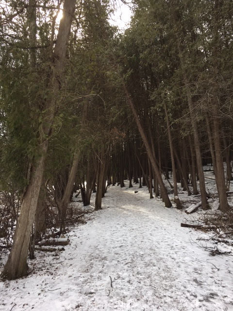
The trail traveled south, following this amazing little hemlock-shaded ravine and creek. This type of scenery was awarded mere minutes from the trail head (a "plus" for people looking to do a short walk here).
After an uphill climb and a sharp turn to the east, the trail crossed the stream, passed under more, yet younger hemlocks, and then eventually crossed dirt Burnt Hill Road. On the road's other side, I entered into a more deciduous forest of tall hardwoods that clearly remain bare from winter. This was also a gentle uphill walk.
At precisely the point where I felt I needed to re-hydrate with some water I brought, the Ravine Trail terminated at the Interloken Trail, and it is here where I turned right (south). What I enjoy about the Interloken Trail is not only its length or the fact that it reaches the Finger Lakes Trail if you go far enough, but that much of it travels under a healthy, mature deciduous forest of oaks, crowning maples, and hickories. Occasionally puncheon bridges take me over wetter spots and natural springs.
As I mentioned before, this national forest has active pastureland where cattle graze when it's warmer, and a few of the trails pass right through these expanses. Below you can see the first views through the tress of the open land.
Just beyond and past a gate with a chain, I entered the spectacular grassland and its unforgettable views to the west of Seneca Lake and the hill country surrounding. A favorite spot of mine!
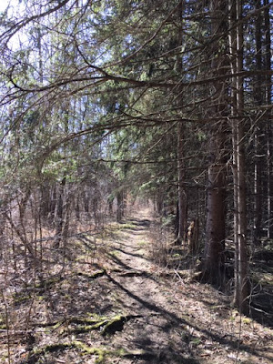
I continued south on the orange-blazed trail, returning into the reaches of more deciduous woods and hiking along slightly rolling terrain.
The intersection with the Gorge Trail came next:
Turning east on the Gorge Trail brought me downhill through considerably more rugged terrain compared to what I've encountered on this hike so far, but that meant more interesting topography.
The Gorge Trail was an out-and-back, as it ended at dirt Mark Smith Road. At this point in time, I knew I wouldn't have time to hike the Burnt Hill Trail (crossed earlier) so I chose instead to continue about a quarter of a mile further south of the Gorge Trail starting point and down the Interloken Trail to a specific place I only once visited: a pretty little pond that is similar to the ones seen up by Foster Pond. The short trek there was a bit muddy in spots but passed by some stands of interesting pines with larger cones than those seen on the more common red pine.
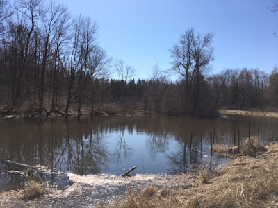
Next came this pond, which seemed a bit brownish in color, likely from mixing waters and all the melting snow. But - still - what a great sun-warmed spot to sit and take it all in!
This, it turns out, is actually the farthest along the Interloken Trail I've been. Someday I would like to take it to its terminus at the FLT.
The second half of my hike consisted of backtracking the Interlaken Trail, and then once reaching the Ravine Trail, taking the other side of that loop.
The air started getting colder by the end of this outing (not surprising since it's only March). But what a terrific return into the woods this was, despite it being early in the season. Until next time . . .


There you can download for free, see the first of these data. cryptocurrency price ticker
ReplyDelete