Taylor Valley State Forest - Seacord Hill
One of the initial purposes of this blog was to find and explore places I've never been to. Admittedly I tend to "stick" to hiking in areas I am familiar with since I know I enjoy them each time, not so much out of lack of curiosity. But I also yearn to branch out and, over time, see what else is out there. Taylor Valley Forest, located in eastern Cortland County, is one of those places. Having seen it on maps many times before, Taylor Valley has been on my "radar" for quite a while, as a relatively lengthy segment of the Finger Lakes Trail happens to pass through. Topographic maps indicated it being excessively hilly, as well, which meant to me that it could be a nice challenge to try a day hike there. A goal of mine is to see as much as the FLT through Central New York as I can in the coming years.
I finally decided to visit Taylor Valley Forest, owned and run by the NYS DEC, on what turned out to be a stunningly beautiful dry, sunny early June day. This spring continues to be a bit rainy, so any day like this one is welcome around here. The forested property, encompassing 4,638 acres, can be hard to find if you're not terribly familiar with the area, and it requires driving down many back country roads to get to the trail head. East of Interstate 81 a few miles and south of State Route 80 a few miles is one way to describe its location. The FLT runs through the state lands in a northeasterly direction for about 7 and a half miles, traversing over Mount Roderick (reaching an elevation of 1909 feet above sea level) and then Seacord Hill. Taylor Valley Road runs through the forest, going southeast, and this is where I picked up the trail to begin my hike.
First off, the pavilion area where the FLT crosses was tucked into a pretty valley towered by large hills on both sides, which made for an interesting starting point in itself. There is a map sign here which shows the FLT as a red dotted line connecting Taylor Valley to its neighbor to the north, Cuyler Hill State Forest. The names of hills are also identified.
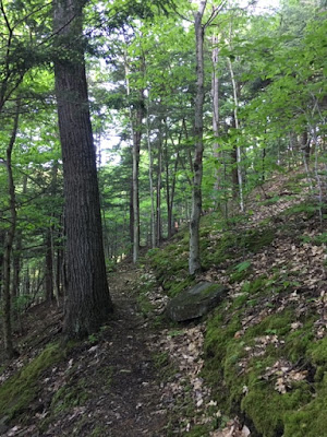
From the pavilion I followed the path south across a grassy area where bugs were flying all over, then followed it northeast uphill where things got steep quickly. I was expecting this, though, so I was prepared for fast elevation changes. A series of switchbacks characterized this part of the path, as did swaths of moss on hill edges which I do not normally see. If I looked too fast, I would think I was in the mountains. The switchbacks lasted for a bit before I came upon a pleasant surprise that was not on the map: a new lean-to built in 2017 named the Taylor Valley Lean-To. I spent a moment here to get some water and hydrate for the continued uphill hiking.
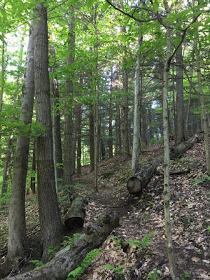
Half an hour into the hike, the woods were splendid and mature with tall trees and a healthy under story. The trail turned here and there, passing under huge sugar maples and shagbark hickories. Eventually there were small stands of red pines mixed in before I found a delightful clearing to my left. A small seasonal stream crossing followed where I could see the edges of a grassy field looking to the southeast. This is the interior of Seacord Hill with Allen Hill adjoining, making for more rolling topography.
It was mid-morning by the time I reached an opening in the forest where logging had once been done. There was not one cloud in the sky, and the air was starting to warm. Areas that were logged, I find, can sometimes give you more of an open feel when in the woods, although I'd rather not see any trees destroyed at all.
I next crossed a grassy unnamed path that was once a jeep trail. Over the next half-mile or so, the FLT flanked along the boundaries of private land where the aroma of flowering apple and dogwood trees greeted me. The private land was gorgeous, with an unusual mix of younger trees not typically seen in a hardwood forest. It seems there may have once been a farm or some type of tree nursery here. Hiking along this very straight segment which was also a little overgrown in places, I was walking parallel to an old barbed wire fence before the trail banked to the right and headed east. Posted signs, meanwhile, made it clear that the property owner does not want anyone trespassing on his land. Fair enough.
Now the next part of the trek had me, in all honestly, rather frustrated. It seems new logging is occurring on the downhill east-facing slope of Seacord Hill to such a degree that the trail is almost impossible to follow. Where did all the white trail blazes go? Well, upon investigating this some, I found that trees painted with those blazes have torn down amidst the logging. I understand this stretch is private land and am grateful we are able to hike through it, but, at the same time, it seems a little careless to allow the FLT blazes to be destroyed. Perhaps, in the near future, the trail will be rerouted or new blazes painted. I certainly hope that's the case, because finding my way through this area was very challenging and, at one point, I almost contemplating turning back and giving up the rest of my planned outing. I'm glad I didn't, though, because after I bushwhacked the torn-up hillside I found and re-joined the trail just before it reached the next paved road crossing: Cheningo-Solon Pond Road. After all was said and done, I lost about a half an hour of time trying to find the trail.
Once I crossed the road, the next section was much more rewarding and my frustration quickly evaporated. I was immediately back in beautiful scenery as I followed dirt Freeman Road across this valley:
It was a little wet in spots, but the tall grasses, fields of yellow buttercups, stands of larch trees, and views of the hills ahead made up for it.

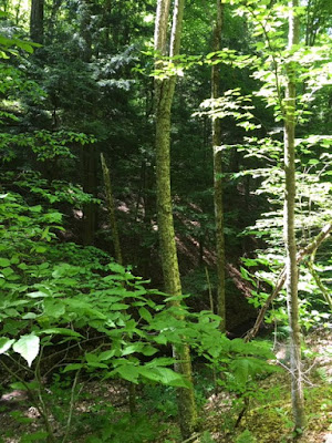
 The FLT, clearly marked again, turned off Freeman Road and headed back into woods. There were more uphill climbs, passing yellow birch and hemlock trees growing on ravine edges.
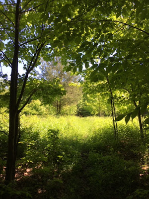
I then reached this tucked-away clearing at the top of the hill where young sugar maples captured the late morning sunlight.
There was just something about this clearing I liked. Maybe how unexpected it was. It also made a great resting spot.
Further onward, the path entered a more open forest where the sun was feeling stronger. I was now stepping into Cuyler Hill State Forest (5,507 acres). In Cuyler Hill Forest, the beloved FLT meandered into more deep northern hardwood forest.
Cuyler Hill is eventually I place I want to hike through and explore, to be sure, but not on this day. Time wouldn't allow, so I had to find a spot to turn back.
This creek deep in the woods, after crossing a couple of snowmobile trails, would do:
This was an out-and-back hike, meaning I more or less returned the same way I came. Maps indicate there are loops you can take in Taylor Valley Forest, but my intent was to stick to the FLT. I was happy I did. Even though I had to retrace through that logged hillside (which I navigated better this time around), it was enticing to see everything a second time in the opposite direction. Made for a different perspective. I also used the Taylor Valley lean-to mentioned earlier to take a long break which I needed.
My hike in Taylor Valley Forest was overall great, with the exception of a couple of troubled spots. The general remoteness of this area gives it extra appeal, in my opinion. I did not come across one other traveler. I would come here again, yet I am especially interested in going further east through Cuyler Hill Forest which maps show to be even more wooded and having more trails . . .
I finally decided to visit Taylor Valley Forest, owned and run by the NYS DEC, on what turned out to be a stunningly beautiful dry, sunny early June day. This spring continues to be a bit rainy, so any day like this one is welcome around here. The forested property, encompassing 4,638 acres, can be hard to find if you're not terribly familiar with the area, and it requires driving down many back country roads to get to the trail head. East of Interstate 81 a few miles and south of State Route 80 a few miles is one way to describe its location. The FLT runs through the state lands in a northeasterly direction for about 7 and a half miles, traversing over Mount Roderick (reaching an elevation of 1909 feet above sea level) and then Seacord Hill. Taylor Valley Road runs through the forest, going southeast, and this is where I picked up the trail to begin my hike.
First off, the pavilion area where the FLT crosses was tucked into a pretty valley towered by large hills on both sides, which made for an interesting starting point in itself. There is a map sign here which shows the FLT as a red dotted line connecting Taylor Valley to its neighbor to the north, Cuyler Hill State Forest. The names of hills are also identified.
From the pavilion I followed the path south across a grassy area where bugs were flying all over, then followed it northeast uphill where things got steep quickly. I was expecting this, though, so I was prepared for fast elevation changes. A series of switchbacks characterized this part of the path, as did swaths of moss on hill edges which I do not normally see. If I looked too fast, I would think I was in the mountains. The switchbacks lasted for a bit before I came upon a pleasant surprise that was not on the map: a new lean-to built in 2017 named the Taylor Valley Lean-To. I spent a moment here to get some water and hydrate for the continued uphill hiking.
Half an hour into the hike, the woods were splendid and mature with tall trees and a healthy under story. The trail turned here and there, passing under huge sugar maples and shagbark hickories. Eventually there were small stands of red pines mixed in before I found a delightful clearing to my left. A small seasonal stream crossing followed where I could see the edges of a grassy field looking to the southeast. This is the interior of Seacord Hill with Allen Hill adjoining, making for more rolling topography.
It was mid-morning by the time I reached an opening in the forest where logging had once been done. There was not one cloud in the sky, and the air was starting to warm. Areas that were logged, I find, can sometimes give you more of an open feel when in the woods, although I'd rather not see any trees destroyed at all.
Now the next part of the trek had me, in all honestly, rather frustrated. It seems new logging is occurring on the downhill east-facing slope of Seacord Hill to such a degree that the trail is almost impossible to follow. Where did all the white trail blazes go? Well, upon investigating this some, I found that trees painted with those blazes have torn down amidst the logging. I understand this stretch is private land and am grateful we are able to hike through it, but, at the same time, it seems a little careless to allow the FLT blazes to be destroyed. Perhaps, in the near future, the trail will be rerouted or new blazes painted. I certainly hope that's the case, because finding my way through this area was very challenging and, at one point, I almost contemplating turning back and giving up the rest of my planned outing. I'm glad I didn't, though, because after I bushwhacked the torn-up hillside I found and re-joined the trail just before it reached the next paved road crossing: Cheningo-Solon Pond Road. After all was said and done, I lost about a half an hour of time trying to find the trail.
Once I crossed the road, the next section was much more rewarding and my frustration quickly evaporated. I was immediately back in beautiful scenery as I followed dirt Freeman Road across this valley:
It was a little wet in spots, but the tall grasses, fields of yellow buttercups, stands of larch trees, and views of the hills ahead made up for it.

 The FLT, clearly marked again, turned off Freeman Road and headed back into woods. There were more uphill climbs, passing yellow birch and hemlock trees growing on ravine edges.
 I then reached this tucked-away clearing at the top of the hill where young sugar maples captured the late morning sunlight.
There was just something about this clearing I liked. Maybe how unexpected it was. It also made a great resting spot.
Further onward, the path entered a more open forest where the sun was feeling stronger. I was now stepping into Cuyler Hill State Forest (5,507 acres). In Cuyler Hill Forest, the beloved FLT meandered into more deep northern hardwood forest.
Cuyler Hill is eventually I place I want to hike through and explore, to be sure, but not on this day. Time wouldn't allow, so I had to find a spot to turn back.

This creek deep in the woods, after crossing a couple of snowmobile trails, would do:
This was an out-and-back hike, meaning I more or less returned the same way I came. Maps indicate there are loops you can take in Taylor Valley Forest, but my intent was to stick to the FLT. I was happy I did. Even though I had to retrace through that logged hillside (which I navigated better this time around), it was enticing to see everything a second time in the opposite direction. Made for a different perspective. I also used the Taylor Valley lean-to mentioned earlier to take a long break which I needed.
My hike in Taylor Valley Forest was overall great, with the exception of a couple of troubled spots. The general remoteness of this area gives it extra appeal, in my opinion. I did not come across one other traveler. I would come here again, yet I am especially interested in going further east through Cuyler Hill Forest which maps show to be even more wooded and having more trails . . .









Comments
Post a Comment